Banc yr Helyg, nr Bridgend
Details for this wood
Guide price: £56,000 - Freehold
Size: Over 4 acres
Location: Blackmill, Bridgend
OS Landranger: 170
Grid ref: SS 962 865
Nearest post code: CF35 6EW
Contact: Sandra Colley
Phone: 07769654392
Email: [email protected]
Email to a friend
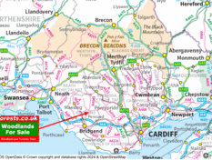
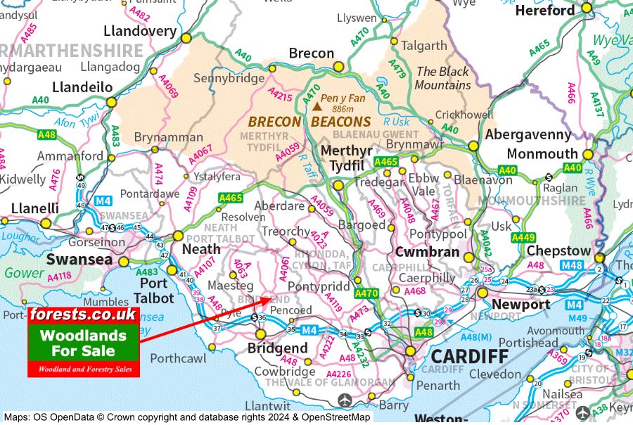
Banc yr Helyg is a mixed woodland of both conifers and broadleaf trees, part of a larger woodland known as Gelli Feddgaer. It is located on the edge of Mynydd y Gaer, only fifteen or so minutes from the M4 near Bridgend, and within easy reach of Cardiff or Swansea.
It is made up of both the north and south banks of a good sized stream. A stand of mature larch makes up most of the north western quarter, a sloping bank with the stream bed at its foot rising up to a grassy bank at the top, pretty with bluebells, which runs along the fence line of the northern boundary. From this high point there are bucolic views out over the fields to the hills and heath of the common land beyond.
The stream which cuts through the middle of Banc yr Helyg runs over rocks and pebbles, forking and creating flat areas thick with ferns, thriving in the damp environment.
South of the stream the land slopes back up to the track. Tree growth is mainly broadleaf on this side, a mixture of oak, ash and sycamore and some areas of hazel coppice.
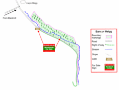
The undergrowth has grown extravagantly this year, making some areas difficult to walk through at the moment, but under the canopy of the conifers on the far side of the stream the going is much easier. There are a couple of places, near the main gate, and just before the Banc yr Helyg name board, where you can walk down to and cross the stream. In a couple of places on the southern side of the stream, at the eastern end of the wood, the ground is very boggy, but most of the woodland is perfectly firm under foot.
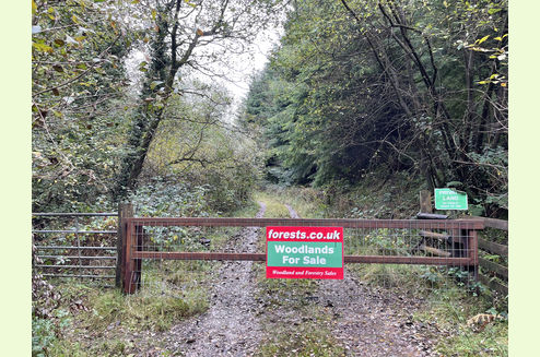
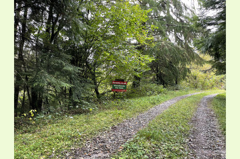
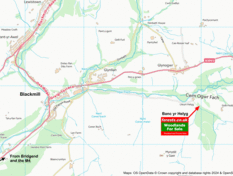
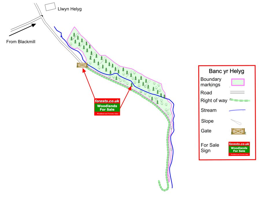
Access: A tarmac road designated as a BOAT (Byway Open to All Traffic) runs from Blackmill most of the way to the wood. A stoned access track takes you the last hundred yards or so to the entrance gate, and then into the wood. The track is suitable for ordinary cars with a little care. The parking area for the wood is half way along the length of Banc yr Helyg, a pull in off the shared access track.
Public access: The land to the west of the Gelli Feddgaer woodland is Coity Wallia Commons, but the woodland is not common land, and there are no public footpaths or public access within the wood.
Sporting rights: Included
Mineral rights: Included, except as reserved by statute.
Local area and history: Banc yr Helyg is located at the edge of Mynydd y Gaer, where it is believed that King Caradoc 1st, son of Arch, built his fabled fortress city Caer Caradoc in the first century AD and from where he fought the Romans from 42-51AD. His burial mound, Twyn Caradoc is to be found a short distance east of the woodlands and on the highest point of Mynydd y Gaer.
The Ogwr Ridgeway Walk passes across the common land just south of the woodland. Nearby Blackmill has a Londis for basic supplies, but Bridgend and even Cardiff are within easy reach for any necessities. The stream that runs through this wood feed into the Afon Ogwr Fach, which feeds the Afon Ogwr which meets the Bristol Channel at Ogmore on Sea with its castle, estuary with fun stepping stones and expansive, sandy beach; a favourite for dog walks.
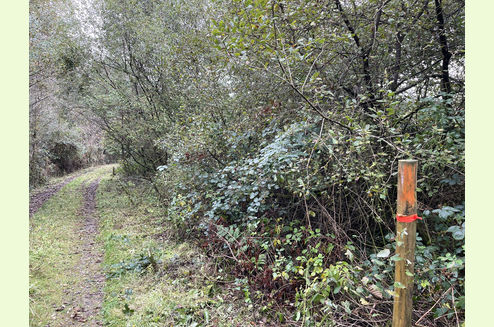
Boundaries: The northern and western boundaries are fenced from adjoining farmland. The southern boundary is fenced, up to the point where you reach the main access gate. Beyond that point it is the main access track itself. The eastern boundary is marked with stakes, identified with orange paint (or tape).
Covenant: in common with the neighbouring woodlands, there is a covenant designed to ensure that all can have quiet and peaceful enjoyment of their woodland.
Photographs: were taken in August 2021 and October 2024.
VIEWING: You are welcome to visit this wood by yourself. Please ensure that you have a copy of these sales details with you: we recommend either printing the details or downloading them to your phone/tablet/laptop before you go. Please take care when viewing as the great outdoors can contain unexpected hazards and woodlands are no exception, including a couple of wet areas where the silt is very deep.
Our Maps
Directions
Exit the M4 at Junction 36.
Take the A4061 (N) towards Bryncethin.
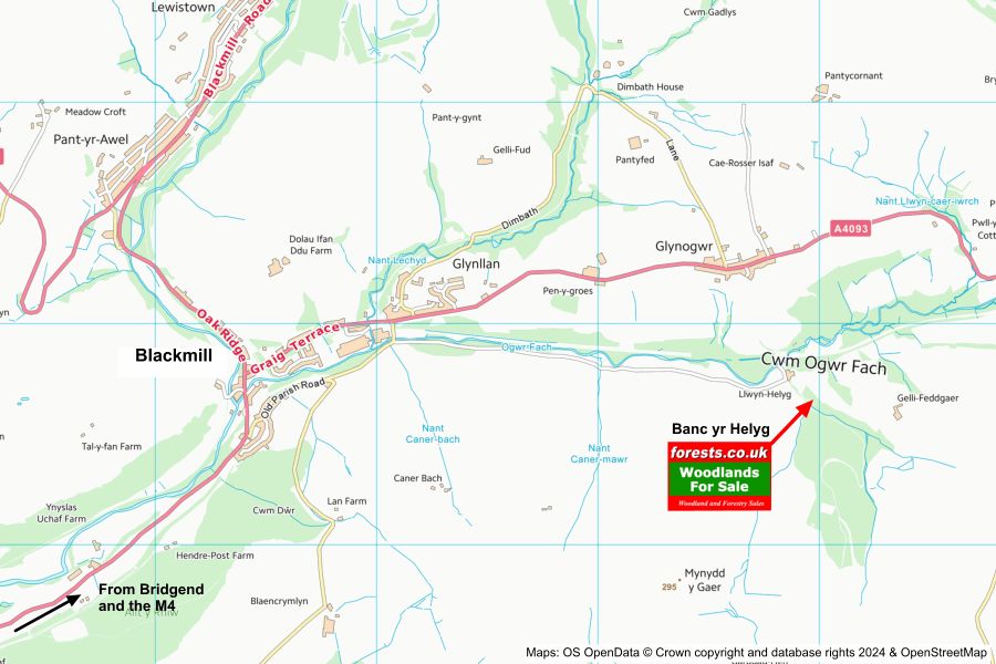
Carry on until you reach Blackmill, then turn right onto the A4093.
After 1/4 mile approximately, turn right onto a minor road, just after a bus stop, and just before a pillar post box you will see on the opposite side of the road.
Follow the road over a metal bridge, and then turn immediately left, over a cattle grid, onto a minor road parallel with the river for 1 mile.
At the end of the road, near LLwyn Helyg farm, the access road is on your right. Park here (but please do not obstruct the road or access track) and continue on foot, through a metal gate at the entrance to the woodland. Banc yr Helyg is the woodland on the left of the track. The parking area, marked with a name board and a For Sale sign, is about 250 metres along the track..
- Nearest postcode for SatNav: CF35 6EW (at the end of the BOAT)
- Coordinates for the entrance gate: 51.5689,-3.50246
- What3Words: gracing.trash.prickly
Please note: there is a combination lock on the pedestrian gate at the entrance. Please contact us in advance for the code if you are going to view the wood.
Please note: the particulars with plans, maps, descriptions and measurements are for reference only and although carefully checked we cannot guarantee their accuracy and do not form part of any contract. Any intending purchasers must satisfy themselves by inspection or otherwise as to the correctness of these particulars.
Location maps
View and print this wood's location on Bing Maps »
Interested in this woodland? Get in touch with us:
Contact Sandra Colley on 07769654392 or email us at [email protected] with your details.


